Rare ‘triple dip’ La Niña declared
- Published

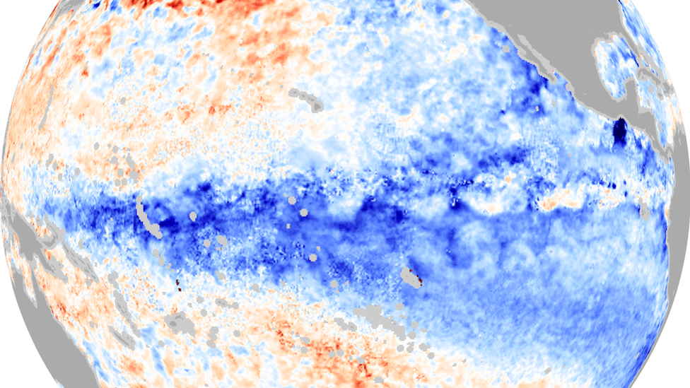
An image showing the colder waters in the Pacific that characterise a La Niña event
The Australian Bureau of Meteorology (BOM) has announced that the weather phenomenon La Niña has formed for the third consecutive year in the Pacific.
This is only the third time since records began that there have been three consecutive La Niña events.
"It is exceptional to have three consecutive years with a La Nina event," WMO Secretary-General Petteri Taalas said.
What is La Niña?
Ben Rich explains La Niña
La Niña is a naturally occurring event, which results in the large scale cooling of ocean surface temperature.
It is responsible for changing weather patterns around the world but one of its greatest impacts is to bring above average rainfall to parts of eastern, northern and central areas of Australia.
Head of long-range forecasts at BOM, Dr Andrew Watkins, said that climate influences like La Niña and another called the Indian Ocean Dipole, "push Australia's climate towards a wetter phase, and together have shaped our outlook for the coming months that shows more than 80% chance of above average rainfall for many parts of the eastern half of Australia".
Dr Watkins went on to say that, "with catchments already wet, the flood risk remains, particularly for eastern Australia."
Parts of Australia have experienced heavy rain and flooding over the last two years, coinciding with the double-dip La Niña
The La Niña weather pattern is one of the three phases of the El Niño Southern Oscillation (ENSO). This refers to the sea surface temperature and direction of wind in the Pacific. It can switch between the warm phase called El Niño, the cooler La Niña and a neutral phase.
Cycling through these phases generally takes around three to seven years but this is now the third year in a row where we have stayed in the cooler La Niña phase.
Scientists refer to it as a "triple-dip" and this is the first time this century it has happened.
Triple-dip La Niña's have only happened twice since records began in 1950 - the first from 1973 to 1975 and the most recent 1998-2001.
World weather impacts
As well as bringing increased rainfall to Australia, La Niña can bring an increase in tropical cyclone activity in the Atlantic and drier conditions in East Africa.
A fourth season of failed rains is currently causing one of the worst droughts East Africa has seen in decades.
Ethiopia, Kenya and Somalia are on the brink of an unprecedented humanitarian catastrophe, according to the UN. The UN's World Food Programme says up to 20 million people are at risk of severe hunger.
La Niña and UK weather
Scientists are generally less certain on how La Niña influences the UK's weather patterns but the Met Office suggests that historically it promotes high pressure to develop in the Atlantic in late autumn and early winter.
This tends to put a stop to the milder prevailing southwesterlies and can cause cold weather.
Later in the winter, La Niña can drive the jet stream further north, which can lead to an increase in stormy conditions and heavy rainfall.