Storm Franklin: UK's third storm in a week causes major flooding
- Published
- comments

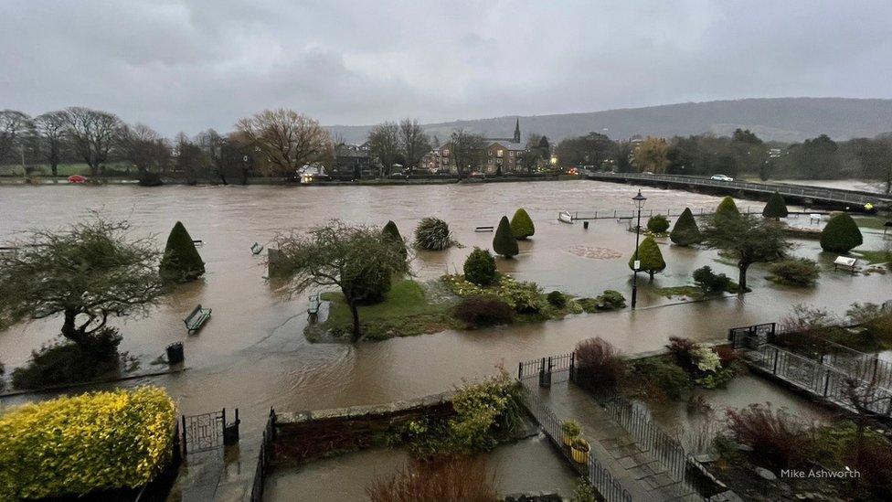
The River Wharfe in Otley, West Yorkshire, after bursting its banks
The UK's third storm in a week hit the country last night, causing some people to evacuate their homes due to severe flooding.
It's been named Storm Franklin and has come hot on the heels of Dudley and then Eunice, which caused lots of disruption and damage over the last seven days.
The UK's seeing so many storms right now because a corridor of wind called the jet stream has been getting stronger as a result of big temperature changes in the Atlantic Ocean.
Storm Eunice caused severe damage to the O2 arena - rapper Dave had to cancel his gigs scheduled there this week while it's being repaired
The Met Office has put two weather warnings in place for parts of the UK.
Northern Ireland has an amber warning for wind today, and a yellow weather warning for wind has been set for Wales, Northern Ireland, most of England and parts of South-West Scotland until 1pm.
There are also more than 150 flood warnings across the country, with the most severe in place in Didsbury and Northenden in Greater Manchester, along the River Mersey. Some homes had to be evacuated in the area as flooding could put the people living there in danger.
The River Don burst its banks in Sprotbrough, South Yorkshire on Sunday evening, with South Yorkshire Police urging people to avoid the area "for their own safety".
Northern Ireland also saw severe flooding and there were efforts to prevent rivers from bursting their banks
Some railway companies such as CrossCountry trains, which runs services from Aberdeen, through Birmingham and to the South West, are asking people not to travel today unless absolutely necessary.
Storm Franklin followed closely behind Dudley and Eunice last week, making it the first time three named storms have been recorded in seven days since 2015, when the naming system began.
Why are there so many storms at the moment?
Becky Mitchell, a meteorologist (someone who studies weather and climate) at the Met Office, said over the weekend: "At the moment we've got a really active jet stream, which is why we're seeing so many storms track right towards the UK."
A jet stream is a fast-flowing current of air moving around the world from west to east, about five to seven miles above the Earth's surface. The jet stream that most affects weather in the UK is called the Polar Front Jet, and is like a ribbon of wind travelling between cold air from the North Pole, and hot air from nearer the equator.
Big differences in temperature can make the jet stream stronger, and when weather systems come into contact with it, they can develop into storms more quickly.
This is what's happening at the moment, and why we're seeing so many storms in the UK right now.
- Published15 November 2023
- Published31 August 2023
- Published14 December 2017
